

Asesoría técnica especializada para optimizar cada etapa del proyecto minero
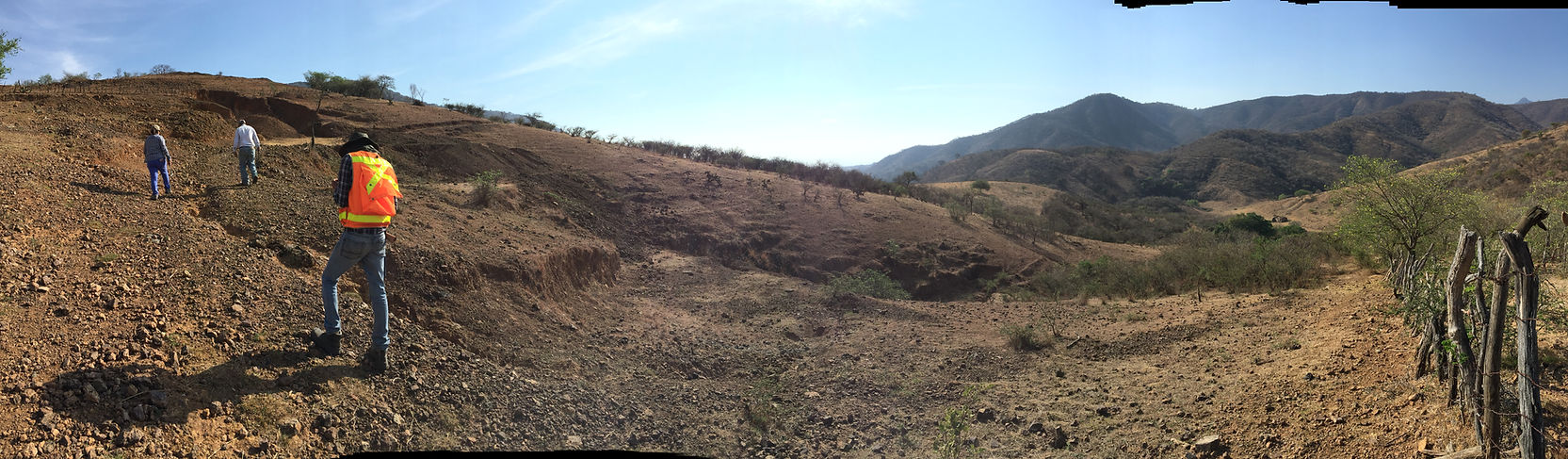
GEOLOGÍA APLICADA EN PROYECTOS DE EXPLORACIÓN

PROGRAMA DE EXPLORACIÓN
Diseñamos y ejecutamos campanas de exploración minera a diferentes escalas, integrando información geológica, geoquímica y geofísica para optimizar la definición de blancos de perforación y modelacion de depósitos,

EVALUACIÓN DE PROPIEDADES Y PROSPECTOS
Analizamos técnicas y geológicamente propiedades mineras mediante mapeo estructural, muestreo detallado y modelado de recursos, generando información clave para la toma de decisiones y negociación de proyectos.

INFORMES TÉCNICOS NI 43-101
Preparamos informes técnicos bajo estándares internacionales (NI 43-101) para respaldar la estimación de recursos y la presentación de resultados a inversionistas y entidades regulatorias.

CARTOLOGÍA GEOLÓGICA Y MAPEO DE AFLORAMIENTO
Elaboramos mapas geológicos y estructurales para caracterizar litológicas, sistemas de alteración y estructuras mineralizadas, brindando soporte técnico a programas de exploración y desarrollo de proyecto.

GEOLOGÍA REGIONAL Y DE RECONOCIMIENTO
Realizamos estudios tecnológicos a nivel regional para identificar zonas prospectivas mediante mapeo geologico, muestreo geoquímico y análisis de alteraciones. Estos datos permiten definir áreas con alto potencial de mineral

PERFORACION
Especializamos en el diseño y ejecucion de campañas de perforacion a todas las escalas. Tenemos amplia experiencia en perforacion de diamante y de circulacion inversa, y utilizamos instrumentos analyticos y equipo propios para dar informacion confiable y a bajo costo.

EXPLORACIÓN Y GEOLOGÍA EN MINAS
Asesoría técnica en geología aplicada a operaciones mineras, diseño de campanas de perforación y control de leyes para optimizar la extracción.
.jpg)
MAPEO DE ALTERACIONES
Identificamos zonas de alteración hidrotermales mediante cartografía detallada, muestreo y análisis geoquímico para optimizar la exploración minera.